
Somewhat Walkable
67
Walk Score ®
Out of 100
You might be able to get out and walk when living in this area. Some errands can be accomplished on foot, but for others you’ll need a car.

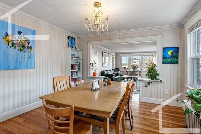
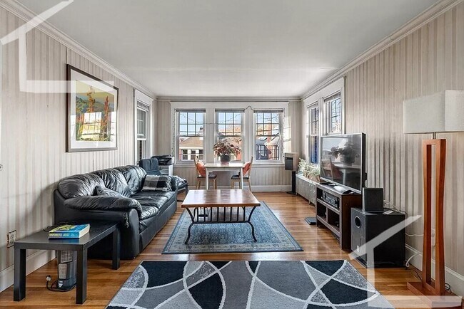
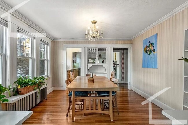
88 Colborne Rd, Boston, MA 02135
88 Colborne Rd, Boston, MA 02135
Url: http://offcampus.tufts.edu/housing/property/8-1-huge-3br-near-green-line-w-eik-pantry-yard-dining-room/mrd4w0j
Phone Number: (617) 549-2177
Data provided by TravelTime
| Number of Bedrooms | Number of Bathrooms | Rent Range | Square Footage | Name of Floor Plan | Unit Number | Availability | Newly Added | View More Details |
|---|
| Washington Street Plaza | Walk: 10 min | Distance: 0.6 mi |
|---|---|---|
| Washington Square | Walk: 17 min | Distance: 0.9 mi |
| Allston Marketplace | Walk: 24 min | Distance: 1.3 mi |
| Boston Support Center | Drive: 15 min | Distance: 6.4 mi |
|---|
| Chiswick Road Station | Walk: 8 min | Distance: 0.4 mi |
|---|---|---|
| Washington Street | Walk: 8 min | Distance: 0.4 mi |
| Sutherland Street Station | Walk: 5 min | Distance: 0.3 mi |
| Chestnut Hill Avenue Station | Walk: 11 min | Distance: 0.6 mi |
| Warren Street Station | Walk: 14 min | Distance: 0.7 mi |
| Newtonville | Walk: 68 min | Distance: 3.5 mi |
| Yawkey | Walk: 53 min | Distance: 2.8 mi |
| Ruggles Station | Walk: 67 min | Distance: 3.5 mi |
| Boston Landing | Drive: 9 min | Distance: 4.3 mi |
| Porter Square | Drive: 10 min | Distance: 4.6 mi |
| General Edward Lawrence Logan International | Drive: 18 min | Distance: 9.6 mi |
|---|
| Boston College, Brighton | Walk: 19 min | Distance: 1.0 mi |
|---|---|---|
| Boston College | Walk: 29 min | Distance: 1.5 mi |
| Boston University | Walk: 47 min | Distance: 2.5 mi |
| Emmanuel College | Walk: 55 min | Distance: 2.9 mi |
| Chestnut Hill Reservation | Walk: 14 min | Distance: 0.8 mi |
|---|---|---|
| John Fitzgerald Kennedy National Historic Site | Walk: 31 min | Distance: 1.6 mi |
| Frederick Law Olmsted National Historic Site | Walk: 36 min | Distance: 1.9 mi |
| Hammond Pond Reservation | Walk: 48 min | Distance: 2.5 mi |
| Coit Observatory | Walk: 47 min | Distance: 2.4 mi |